HEAVY TO VERY HEAVY RAINFALL VERY LIKELY OVER NORTHWEST AND NORTHEAST INDIA IN NEXT 4-5 DAYS, SAYS IMD
Heavy to very heavy rainfall is very likely over northwest and northeast India in the next four to five days, said the India Meteorological Department’s latest forecast on Saturday.
According to the IMD, heavy to very heavy rainfall with extremely heavy falls occurred at isolated places over Tamil Nadu, Meghalaya, sub-Himalayan West Bengal, and Sikkim, heavy to very heavy rainfall at isolated places over Uttar Pradesh, Odisha, Arunachal Pradesh, Konkan, Goa, central Maharashtra, Gujarat Region, and south interior Karnataka, and heavy rainfall at isolated places over Uttarakhand, Punjab, Rajasthan, Madhya Pradesh, Vidarbha, Chhattisgarh, Gangetic West Bengal, coastal Karnataka, and Kerala.
The southwest monsoon has further advanced into the remaining parts of eastern Uttar Pradesh and some more parts of western Uttar Pradesh on Saturday, it said.
Conditions are favourable for further advance of the monsoon into some more parts of western Rajasthan, Haryana-Chandigarh, Punjab, remaining parts of western Uttar Pradesh, Himachal Pradesh, and Jammu during the next 2-3 days, said the forecast.
As per the IMD, a cyclonic circulation lies over northeast Arabian Sea adjoining Saurashtra and Kutch in middle tropospheric levels. Because of this, fairly widespread to widespread light to moderate rainfall accompanied by thunderstorms and lightning is very likely over Kerala, Mahe, Lakshadweep, coastal Karnataka, Konkan, Goa, Gujarat, and central Maharashtra, isolated to scattered light to moderate rainfall over Marathwada, Tamil Nadu, Puducherry, Karaikal, coastal Andhra Pradesh, Yanam, Rayalaseema, Telangana, north and south interior Karnataka in the next five days.
The forecast said isolated heavy rainfall is very likely over Saurashtra, Kutch, Kerala, Mahe, Tamil Nadu, coastal Karnataka, south interior Karnataka from June 29-July 1, and in Gujarat, Konkan, Goa, and central Maharashtra from June 29-July 3. Isolated very heavy rainfall is very likely over Konkan, Goa, and central Maharashtra from June 30-July 3.
A low-pressure area lies over northwest Bay of Bengal adjoining the north Odisha-Gangetic West Bengal coasts. A cyclonic circulation lies over northeast Rajasthan at lower tropospheric levels. A cyclonic circulation lies over eastern Uttar Pradesh adjoining Bihar and another over northwest Uttar Pradesh in lower tropospheric levels. Because of this, fairly widespread to widespread light to moderate rainfall accompanied by thunderstorms and lightning is very likely over northwest, central, and east India in the next five days, said the forecast.
According to the weather office, isolated heavy rainfall is very likely over Himachal Pradesh, Uttarakhand, Punjab, Haryana-Chandigarh, Delhi, Uttar Pradesh, Madhya Pradesh, and east Rajasthan during June 29-July 3, western Rajasthan on June 29, July 2-3, Chhattisgarh, Gangetic West Bengal, Jharkhand, and Odisha on June 29-30, and Bihar during June 30-July 2. Isolated very heavy rainfall is likely over Uttarakhand from June 30-July 3, Himachal Pradesh and Punjab from June 30-July 2, Haryana-Chandigarh, Uttar Pradesh, and east Rajasthan from June 29-July 2, and west Madhya Pradesh on July 1-2.
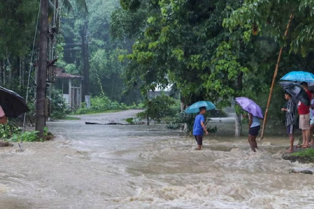
A cyclonic circulation lies over northeast Assam at lower tropospheric levels, because of which, the IMD said, widespread light to moderate rainfall accompanied by thunderstorms, lightning, and isolated heavy to very heavy rainfall is likely over sub-Himalayan West Bengal, Sikkim, Arunachal Pradesh, Assam, Meghalaya, Nagaland, Manipur, Mizoram, and Tripura in the next five days. Isolated extremely heavy rainfall is very likely over Arunachal Pradesh on June 29-30 and Assam and Meghalaya on June 29.
No significant change in maximum temperatures is very likely over most parts of the country, said the forecast.
2024-06-29T11:15:08Z dg43tfdfdgfd